Friday, July 17, 2015

Thursday, July 16, 2015

We are in Cottonwood RV Park in Destruction Bay, BC.  And this is the view out my back window:


Life’s tough out here in the wilderness.

We left Tok, AK, yesterday and did a leisurely 100 miles to Beaver Creek, British Columbia on the Alaska Highway, formerly known as the Al-Can highway.  These are the kind of travel days I love.  No hurry to get somewhere, so plenty of time to stop at interesting spots.

The first unscheduled stop was at the site of the Seaton Roadhouse.  The Al-Can highway was built in 1942 in 8 months, when Canada and the US governments realized that Alaska could become crucial in World War ll and there was no way to get supplies to Alaska.  So the highway was built and along the way roadhouses popped up to supply the workers and travelers.  The highway was just a gravel road and no one attempted any speed, so many stops were necessary.  Airstrips were also built along the way, usually just flat landing stretches.  They were also used for supplies and for ferrying fighter planes to Russia.

Since Steve’s mother’s maiden name was Seaton, we had to stop and check out the roadhouse site.


The roadhouse operated from the 1940’s to the 1960’s, when the Alaskan highway was rerouted to slightly east of the road house.  The Seaton’s abandoned the roadhouse as business dropped off.  The land has become part of a wildlife refuge and is maintained as a recreation site.  

It was 62 degrees out, but there were still a few patches snow, insulated from below by the permafrost.

We then made another stop a short ways down the road at the Wildlife Refuge visitor center.  Steve asked about the Seatons and the native park ranger told of actually meeting Mrs. Seaton when she was a young girl.  Mrs. Seaton was known throughout the area as a good cook.  The rangers have done some research on the Seatons and are emailing Steve a pdf.  You never know where you might find some genealogy information.

The next stop was the Alaskan-Canadian border.  The border is marked by a pillar and a 20 foot wide mowed swath through the forest.


So we entered the Yukon and headed for Beaver Creek, where we parked for the night.

No picture of our site in Beaver Creek; it was slightly better than a gravel parking lot with utilities.  This is roughing it for those of us with RVs.  Many of the RV parks in Alaska and Canada are fairly bare bones – they are more than adequate for a safe overnight, but are by no means resorts where you might spend a week.  But Beaver Creek had water and electricity at our site and the wifi was not bad at all.  Two dump stations were available and we used one when we left this morning.

We only had about 100 miles to go today, but knew that the road would be bad.  Construction on the Alaska highway never really ends.  Each winter parts of the road are torn up by frost heaves and need to be repaved.  Bridges along the route are being replaced in a timely manner, so construction is constant.  We had heard that part of the section we would be on today was down to one lane and we would wait for a pilot car to lead us through the construction.

Construction was as advertised, but didn’t seem quite as bad as we’d heard.  But there were a lot of gravel/dirt sections and we kept our speed down.   The tedium was broken up by several animal sightings.  The first were these swans.
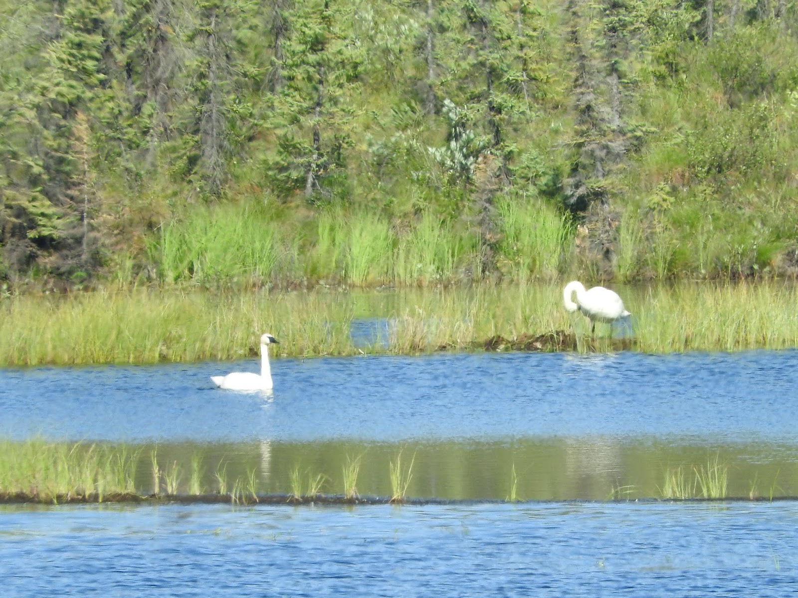
They might be trumpeter swans, who migrate back to this area each summer.  And shortly after, a grizzly bear crossed the road!
Of course, by the time we managed to grab the camera, he was well into the brush.


But at least we both saw the grizzly and have some photographic evidence.   Unlike the fox that appeared by the side of the road a short time later.  I was trying to look up something in the Milepost book and by the time I unearthed the camera, he had trotted back into the woods.

We stopped at a rest area to have lunch and wait for the pilot car to come through to lead us through construction and were lucky enough to visit with some ducks.  They followed me along the shore, probably expecting to get fed, but were mostly enjoying the day.  Several were taking a nap stretched out in the sun on an old deck.


The road construction and traffic:

We did have some beautiful scenery.


Love the snow capped mountains!

And much of the way was lined with wildflowers, the most prevalent of which is the fireweed, so called because it is one of the first things to grow after a wild fire.


Gorgeous!
Deb

Monday, July 13, 2015

Monday, July 13, 2015

We changed our plans; we're now in Tok, Alaska.  More on that in a minute.

Before Alaska became the 49th state of the United States in 1959.  Before the Klondike Gold Rush from 1896-1899 and the Alaska Gold Rush from 1899-1915.  And before U.S. President Andrew Jackson purchased Alaska in 1867, Alaska was a Russian colony.  The Russians started exploring Alaska in 1741, claimed it as a colony, and hunted and traded for furs here.

There are still small Russian-speaking communities in Alaska, and the occasional Russian Orthodox church.  We visited this church in Kenai, Alaska, at the end of the Alaskan tour.  It was only a block away from our campground:


This church was built from logs in 1895-1896 and later covered with siding on the outside and plaster on the inside.  It replaced an earlier church on this site built in 1849.  Father Thomas Andrew, who has been the priest here since 2003, gave us a delightful tour and answered a myriad of questions.  The building was declared a National Historic Landmark in 1970 and is the oldest standing Orthodox church in Alaska.


When I last posted to the blog, we were at the Grand View CafĂ© and RV Park along the Glenn Highway, sharing the scenery with some Dall Sheep.  We had planned to drive to Valdez for a couple of nights, then on to Tok.  However, Deb has not been healing quickly and the weather forecast for Valdez was for five straight days of rain.

So we decided to head straight for the town of Tok (rhymes with “poke”).  This change eliminates a full day of driving.  We’ll spend three nights here, letting Deb sleep in and take some extended naps.  With some luck, this should help her feel better.

We stayed at the Sourdough Campground in Tok for one evening on the tour, the day after we departed from Dawson City and drove over the “Top of the World” highway, on our way to Fairbanks.  There’s not a lot to do in Tok, but the campground is one of the nicer ones we’ve visited in Alaska.  Each campsite is surrounded by Aspen and White Spruce trees, and has full hookups (electricity, water, and sewer).  It also has good AT&T cell phone coverage and weak Verizon service

Our current plan is to drive southeast from Tok on Wednesday, saying good-bye to Alaska for this trip.  We’ll spend the next couple of weeks driving through the Yukon Territory and British Columbia on our way to Calgary, Alberta.

Saturday, July 11, 2015

July 11, 2015

Deb is still recovering, so this is another quick update from Steve.

Today was another travel day; about 220 miles to the north and east from Seward through Anchorage to Glacier View (really small town) along the Glenn Highway.  

The road from Seward north passed several glacial rivers and a couple of lakes.  We weren’t making very good time, as I kept stopping to take pictures, like this view from Kenai Lake:


I mentioned yesterday that we hadn’t seen as much wildlife as we thought we might.  On today’s trip, we stopped at the Alaska Wildlife Conservation Center just outside of the former town of Portage.  (Portage was wiped out by the 1964 earthquake, 9.2 on the Richter scale, strongest North American quake in recorded history.)  The AWCC is a rescue facility for injured, orphaned, and nearly extinct wildlife like eagles, moose, elk, and wood bison.  

It is mostly a drive-through animal park.  Some people walk the 1.5-mile loop (the animals are all behind fences), while others ride a shuttle or tour bus.  We were in a hurry and Deb had limited strength, so we drove the pickup with the fifth-wheel in tow.

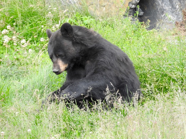
The pens were large and the animals seemed to be quite tolerant of the tourists.  We saw a black bear along the road to Salmon Glacier a month ago, but he didn’t stop to pose like this fellow:


And this was the first Grizzly I’ve seen on the trip that wasn’t stuffed and on display:


I think we learned that Musk Ox date back nearly to the time of the dinosaurs, or at least 200,000 to 90,000 years ago, and entered North America across the land bridge from Asia during the ice ages.  They are well adapted to living in the Arctic polar region:


We’ve seen a number of moose, but almost always mom and calf, or solitary individual.  This would have been way to close for comfort, except for the fence between us.  Please note the mountains in the background:


The final portion of today’s drive was along the main highway (the Glenn Highway), which connects Anchorage to Canada and the lower 48 states.  

You’d be forgiven for thinking this would be limited-access “Interstate” 4-lane divided highway.  In fact, it is a two-lane road, frequently without shoulders or guard rails.  The speed limit is usually 55 or 65, with occasional 30 MPH curves and steep hills (7% grade) that appear at random and mostly without warning.  

With the help of our neighbors, we spotted a few Dall Sheep on the mountain behind our campsite.  To the naked eye, they are nearly invisible white dots out our rear window, way up on the mountain.  With binoculars, they are still very small and somewhat difficult to find.  

My camera has the (35 mm) equivalent lens of 1440 mm (long telephoto).  Even with it, the sheep are just small dots in the middle of the frame.  But with a tripod and cropping the center of the picture, you can mostly see the sheep and its horns:


It was the preservation of the Dall Sheep near Mt McKinley that was the primary motivation for the creation of Denali National Park.

Tomorrow we’re on our way to Valdez, about 200 miles away.

A special reminder and request to our friends in Indiana:  Gary Wolfelt’s summer concert series of oldies bands starts in a couple of weeks.  Deb and I attended all three concerts last summer and had a blast.  Gary could use our help.  (We’ll be attending the September concert.)

The first concert features the Hit Men on Friday, July 24th, at 7:30 pm.  They are former stars of Frankie Valli & the Four Seasons, Tommy James & The Shondells & other mega star acts of the 60s, 70s and 80s.  Weather permitting, the concert will be at the Tippecanoe County Amphitheater with the Long Center as the backup location.  You can find the details at
http://www.allstarentertainment.biz


July 10, 2015

It’s been two weeks since Deb had a chance to post on our trip.  This is Steve, and I’m filling in to give you a quick update.
We are now in Seward, Alaska, at the Stoney Creek RV Park.  Here’s the view from our campsite:


Deb has contracted a sinus infection that has given her a hacking cough and has triggered her asthma.  She is recovering, but it has left her tired and mostly out of commission.  I caught a cold, but have mostly conquered the symptoms.
The guided caravan portion of our Canada and Alaska trip finished a couple of days ago.  After our visit to Denali National Park, we were in Anchorage for 5 days, then Homer for three days, and finally Kenai for three days.  As time permits, hopefully we can share some of our pictures and experiences from the latter portion of the trip.
We were with the group for about 40 days, starting in Hazelton, BC and finishing in Kenai, AK.  There were 24 RVs with 48 “customers”, plus Spike (guide) and Lindy, Johnny and Lynda (tailgunners), and Roger (RV tech) and Teresa.  That’s a large group, but a great group of people.  We all got along, helped each other, and had a roaring good time.  We really miss them!
Overall, the tour turned out better than we could have hoped.  While the weather could have been better at times, we saw fantastic scenery, acres of wildflowers, a good sampling of wildlife, and surprisingly few mosquitoes.  
Spike was a font of information on geology, geography, weather, history, First Nations people (Canada), Native Americans (US), road conditions, driving techniques, the best places to refuel, and where to stop for ice cream or sticky-buns.  
We were all given VHF commercial radios so that he could explain what we were seeing while we were driving, he could warn us of upcoming road hazards, and we could ask questions.  He arranged special tours, special meals, and special speakers, including the teacher at a one-room schoolhouse and two female sled dog racers (Iditarod and Yukon Quest).  When we arrived at each campground, we were directed to our assigned campsites; no waiting in lines to check-in.
While we didn’t see as much wildlife as we had hoped, it is hard to complain about these two Bald Eagles that were perched in a tree between our campground and the coast.  We were on a bluff, so the top of their tree was at our eye level:

Tomorrow morning, we leave Seward and start a two-day drive to Valdez.


Saturday, June 27, 2015

Saturday, June 27, 2015

We are at Denali National Park in Alaska.  We spent yesterday taking a 6.5 hour tour of the park, but were unable to see Mt. McKinley.  Mt. McKinley is so large it creates it’s own climate, usually with clouds and yesterday was no exception.

But the scenery is gorgeous.  Denali encompasses 6 million acres.  The bus took us about 50 miles into the park and back, with a few stops along the way.  The road was mostly dirt and gravel.


They limit vehicle access to most of the park; hiking is unlimited. 

We did spot a few animals:

A young caribou.


Dall sheep


A hawk.

And a golden eagle.  He apparently had his eye on some prey, as he hovered over the same spot for a long time, allowing Steve to get a good shot.


But the scenery stole the show.  It was ever changing and we took way too many pictures.  It was hard to narrow them down to just a few. 


The glaciers created what are called braided rivers – rivers with multiple channels that change often.


The haze in the upper right of the picture above is smoke.  As we turned around to head back to the front of the park, the smoke from some of the forest fires in Alaska was beginning to creep into the park.  We were lucky to have a relatively clear day.  There are over 400 active forest fires in Alaska.  The later tours didn’t see nearly as much, as more smoke kept creeping into the park.

We finished the day off with pizza at a local place that had both a crust AND cheese I could have.  And it was good pizza!  (Or as good as a gluten free, dairy free pizza gets!)

I’m going to create another post or two on our previous adventures, but stop now and try and get this posted.


Deb

Monday, June 15, 2015

Sunday, June 14, 2015

We are in Whitehorse, Yukon, Canada.  And we finally have decent Internet service, although my email is acting odd.  I have to sign on through the Internet to send anything.

First, the view out our window:


We won’t have a lot of spectacular views out our window on the caravan trip.  The primary concerns for where to camp are convenience and enough spaces.  I think we’ve always been close to fuel and frequently within walking distances of attractions.   I’m glad this time that we got a view of trees.

The caravan is going well.  It’s a nice group of people and our RV technician, Roger, has earned his keep in many ways.  Tires have been changed, loose brackets fixed, refrigerators fixed and that’s only what I know about.  Luckily, we've only used him for advice on fixing a bracket.

On Monday, June 1, we went to see the local village totem poles.  Typically, totem poles stand outside a home or along the river bank, but the government worked with the natives to locate some together to enjoy and preserve.


After lunch, those who wanted gathered to walk to the place where the two rivers join and hear Spike (the caravan leader) talk a bit about the history.  The First Nation people (which we would call Native Americans) have lived here for thousands of years.  The rivers provide transportation and food.  There’s a recreation of a native village nearby.  We visited it and had dinner there that night.

 We pulled out of Hazelton, British Columbia, on June 2, headed to Hyder, Alaska.  The caravan is a sight to see.  People point at us and even stop and take pictures.


 We have 26 rigs, 52 people and 22 dogs and one cat.

Hyder, Alaska, sits right on the Canadian border across from Stewart, British Columbia.  It’s a small town and the only way to get there is through Stewart or by sea.  It used to be a large port for the mining companies, but I think airplanes did that in.  It’s the most southern Alaskan town that you can drive to.

It’s also at the southern end of Glacier Highway, which does live up to it’s name.  We visited the Salmon Glacier west of town and had our first chance to throw snowballs.


Coming back from Salmon Glacier, we had our first bear sighting.


We were so excited!

We’ve eaten well on this trip and Hyder was no exception.  One nice thing about the caravan is that the staff can recommend restaurants in a strange town.  We use an IPhone app, Urban Spoon, which has been real helpful in the lower 48 states, but if there’s not cell service, it doesn’t work!  So the staff recommendations have been helpful.  We ate at “The Bus” in Hyder, for great fish and chips.

 You’ll see lots of people in yellow vests in my pictures.  These were handed out as we checked in for the tour.  It makes us easy to spot and helpful when there is a paid admission.

When we left Hyder, we had to go through Canadian customs.  They are real picky about poultry products coming in from the US because of the bird flu.  The Alaskans were having some fun with a sign on their side of the border.
The sign says Eastern Sektor, Checkpoint Charlie, You are leaving the American Sector.  The stone building on the right is a very old checkpoint.  (I think Checkpoint Charlie was a checkpoint on the Berlin wall.)


And another glacier – I think this one is called Bear Glacier.


We left Hyder on June 4, and headed for Dease Lake, British Columbia.  We have three one night stops before we reach Skagway, Alaska.  Distances up here are bigger than Texas. This is just some of the beautiful scenery on the way to Dease Lake.


On June 5, we departed Dease Lake and headed for Watson Lake. It was a rainy day, but we got to drive through great scenery.


 This is our caravan at a rest stop.

 We also see a lot wild flowers along the road and a lot of lilacs when we pass a residence.  I think I need to find a place at home for some lilacs.

Watson Lake is known for it’s sign forest.  During WWII, it became apparent that Alaska and western Canada would be a target for the Japanese and we had no way to supply anyone.  So airfields and the Alaska-Canada highway was built.  The airfields are quite long and I suspect are backup airports even today.  They are still in use and maintained.  Anyway, one of the soldiers stationed in Watson Lake during the building of the highway got homesick and put up a sign pointing to his hometown.  And thus a tradition begins.  The forest covers several acres now.  Several of our tour group posted signs of their own.


 The next day, Saturday, June 6, (it is hard to keep track of the days!) we headed for Teslin, Yukon.  Along the way, we notice things spelled out with rocks.  It's the local version of graffiti.   
More beautiful scenery.

And a decent restaurant with an international flair.  Here’s part of the menu (prices are in Canadian dollars).

At the Continental Divide, we stopped and took a group picture with the dogs.  The one cat wasn't having any part of it.

And then it was on to Skagway, Alaska, where many started their quest for Klondike gold.  These people were nuts.  Dawson, where the gold was found, is almost 500 miles inland.  And the Canadian authorities wouldn’t let you go without 2000 pounds of supplies – which you would need to survive the trip.  And the first thing you needed to do was climb 30 miles up the mountains to reach the Yukon river.  It’s too steep for wagons; most of the horses used died on the way up, giving the trail the nickname of dead horse trail.  And they were climbing in winter.  Most worked with a partner, carrying goods up the trail a way and then heading down for more.  It was back breaking work.

Gold was discovered in 1896.  News reached the world in 1897 and it was 1898 before those who survived the journey reached Dawson.  By then, most of the land had been claimed and there were few opportunities

But the gold rush inspired the building of a railway and the White Pass and Yukon railroad still runs today.  Early in the 20th century, steamships started bringing tourists.  Tourism continues today as the main industry.

Many of the buildings in Skagway date back to the gold rush days.


The scenery is gorgeous.  This river is next to where one of the gold rush trails up the mountain started.


And here are Steve and I actually on the trail.


And a better picture of the trail.  Can you imagine carry 2000 pounds of supplies up it 30 miles, 50 pounds at a time?


Skagway sits on the ocean, but it’s on a narrow fiord.


This was the view from our door at night.  Lots of small fishing boats.  (And people who put them in and out all day and night!)

And in the morning:


As many as 5 cruise ships can dock at Skagway at once.  Note the Disney ship on the right.  One day our guide said there were 12,000 visitors that day.  Less than 1,000 people live there normally.  

We left Skagway and headed for Whitehorse, Yukon Territory on Thursday, June 11.  We’ll mostly be following the route the gold miners took, except we have roads and bridges and vehicles.  We stopped at Caribou Crossing for lunch and a chance to interact with a mushing team that competes in the Iditarod dog sled race.  I played with the puppies.


Again, the scenery is spectacular.  Pictures don’t do it justice.


Whitehorse is the capital and largest city in the Yukon.  Its’ population is about 23,000.  There are only 33,000 people in the Yukon.  If you want to get away from people, this may be your place.

Whitehorse is a good stop for us.  It has a Walmart and an even better Canadian store, so stocking up was easy.  We also took a trip to Miles Canyon, which was a canyon the miners had to come through.  Because it’s so narrow, the river runs fast and there’s a whirlpool near the end.


And, continuing our tradition, we also found some great food!

Tomorrow we head out for Dawson City, Yukon Territory.  This is where the miners were headed to find their gold.  It’s a town full of history.  And hopefully, we’ll have decent Internet!

There are times on this journey that I want to just stop and enjoy what’s around me, but I know that around the next bend is another beautiful view.  The land is so immense that to see much of it, we have to keep moving.  And I know we’ll still not see it all.

As the song says,

“There's more to see than can ever be seen
More to do than can ever be done
There's far too much to take in here
More to find than can ever be found

(Tim Rice, The Lion King, Circle of life.)

So we’ll enjoy as much as we can as we move along.

Deb