Friday, July 24, 2015

Thursday, July 23, 2015

We are at Northern Rockies Lodge on the Alaska Highway between Watson Lake and Fort Nelson.  It’s in British Columbia.  And this is the view out my window:


The side window has a view of the float plane the owners use for flight seeing trips. 


The day in Watson Lake started off with a rainbow.


The scenery was beautiful.


But the stars today were the bison.  First we saw one.


Then two:


And then we found the herd:


Mommas and babies


Six babies in this picture, two laying together poking each other.  Kids will be kids.


And this guy walking up beside us to make sure we weren’t going to cause any trouble.


We saw one more bison, but he was heading into the woods.  But then we saw the black bear!


He posed nicely and was still munching along the side of the road when we moved on.


There was some heavy construction today, but no major delays.  It looks like they are upgrading and straightening out one of the older sections of the highway.  Steve read that they didn’t want a straight highway when it was built, as that would make it easier for the Japanese to shoot up a supply convoy, if war ever came to this land.

The Northern Rockies Lodge is an interesting place.  It’s on its third owners, who bought it as place to base their flight seeing operations.  They fly people up to a remote National Park or to one of their remote cabins for sightseeing and fishing expeditions.  They built a new lodge a number of years ago when their business outgrew the original lodge and now have rooms in the lodge, cabins, most on the lake, and spaces for RVs to park.  And a good restaurant.


A great stop in a beautiful location!  We hope to be back!


Deb

Wednesday, July 22, 2015

Wednesday, July 22, 2015

We are near Watson Lake, Yukon Territory, Canada.  I hope to get this posted today, as we will probably be out of Internet or phone range for several days, although we may have service tomorrow.

Cottonwood Campground is on the shore of Kluane Lake and we enjoyed the beauty here.  The morning we left, a float plane landed.  We think it was scheduled to take some of our neighbors on a sight seeing flight.

We left Cottonwood Campground on July 18 and headed for Whitehorse, Yukon Territory.   The wind was down and not blowing glacier dust down the valley, so we could get a good picture of the lake and mountains from our campsite.

We stopped at the Tachal Dhal Visitor Center for Kluane National Park (Canadian), hoping to see sheep on Sheep Mountain.  But they weren’t visible that morning, so we continued on.

The scenery is beautiful, so we enjoyed the drive.  One guidebook we rely on is called Milepost and I believe they have just about everything along the highways in this part of Canada and Alaska documented.  It suggested we stop at Sulphur Lake, which is supposed to be stopping place for migrating birds and have lots of eagles’ nests around the lake.

It’s a pretty lake, but we only saw one bird.  It was an eagle, but too far away to get a decent picture.  But we enjoyed the view.  I even took an “artsy” picture of it:


The road to Sulfur Lake was single lane and a mixture of gravel and soft sand, which dead-ended at the lake.  With a lot of luck and four-wheel drive, Steve managed to get the trailer turned around and got us back up the hill to the Alaska Highway.

We stopped for lunch at Haines Junction and visited the Kluane National Park headquarters.  The building houses the National Park headquarters, the local visitor center and the First Nations heritage center.  In fact, that seems to be the governing model for most of the area.  The First Nation people have subsistence rights over most of the land, including hunting in national park areas, but also have responsibility to help maintain the land and wildlife.  As an example, there is currently a ban on fishing certain types of salmon in the Dawson Creek area to allow the fish to repopulate.  The First Nation people agree and help administer the ban. 

All along the way, we encounter bicyclists, mostly solos, some pairs and some groups.  This is such rugged country, I’m not sure bicycling solo is a smart thing to do.  But some of the groups are on really long trips.  Note the sign on this bike we spotted at lunch.

Our next stop was Canyon Creek Bridge, which is an old bridge being restored next to the newer one that is used for the highway traffic.  

This area has been a trail for the First Nation people for generations before the Al-Can highway was built.  Originally, wood bison (otherwise known as buffalo) roamed this area and are now being reintroduced.  We didn’t manage to see any in the wild.

It was on to Whitehorse and time to catch up on some chores.  Steve did laundry and got the oil changed on the truck.  He also visited the Copperbelt Railroad and Mining Museum, where he got to ride on a mine train.

Much of the economy of the Yukon and British Columbia rests on mining as well as tourism.  They still mine a lot of gold here, as well as other minerals and jade.

Monday we took in the Yukon Wildlife Refuge outside of Whitehorse.  It was nice to see some of the animals up close that we had only seen in the distance.  And even nicer to see animals that we would never get to see otherwise.

The Arctic Ground Squirrels seemed to think my toes were food and headed straight for me until I screeched and moved.  They weren’t expecting food to move and veered away.  But since this happened at several of our bus stops around the refuge, I don’t think I was imagining things.

Elk are not native to Canada and were introduced during the building of the highway to provide more sources of meat.  They have not thrived very well.

The snowy owl is elusive, but posed politely for us.  She’s injured and can’t fly.

Mule deer have migrated north into Canada and seem to thrive.

This big horned sheep is taking a nap.  I’d have a neck ache!

The musk ox looks prehistoric.

The lynx is good at camouflage and Steve had a hard time getting a good picture.

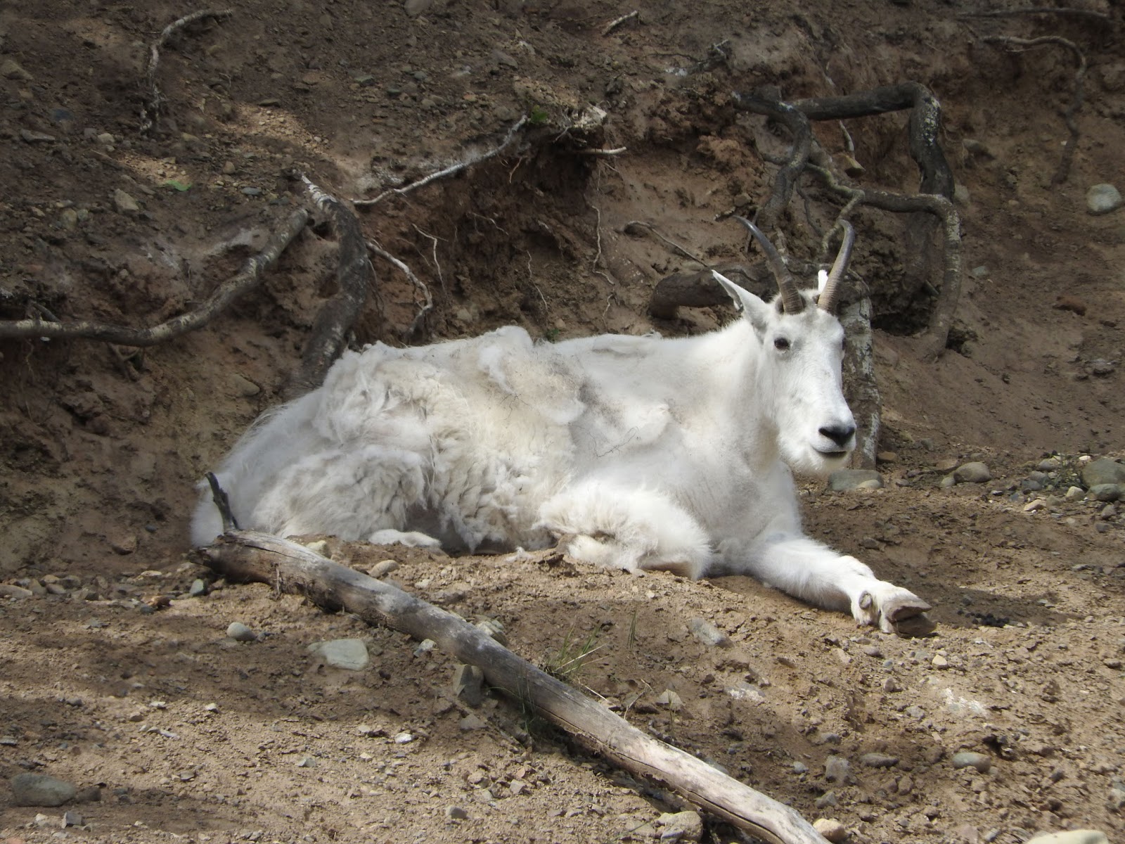
This mountain goat found a shady hillside.

The artic fox was also elusive.  This is his summer fur; his winter fur is white.

The pens for the large animals were appropriately large.  This was as close as we were going to get to a moose at the refuge.

The wood bison was last on the tour.  They were also in a large pen and keeping their distance.

The wood bison were thought to be extinct and then they found a small herd, I think in the Northwest Territory (of Canada), east of the Yukon Territory.  They’ve been breeding them and repopulating them to areas where they used to roam.

We left Whitehorse on Tuesday and drove to Teslin.  Here’s some of the beautiful scenery along the way.


Our campground in Teslin gave us a pretty good view.

And then one of the locals dropped by for a visit.

It was a great way to end the day.

Deb

Friday, July 17, 2015

Thursday, July 16, 2015

We are in Cottonwood RV Park in Destruction Bay, BC.  And this is the view out my back window:


Life’s tough out here in the wilderness.

We left Tok, AK, yesterday and did a leisurely 100 miles to Beaver Creek, British Columbia on the Alaska Highway, formerly known as the Al-Can highway.  These are the kind of travel days I love.  No hurry to get somewhere, so plenty of time to stop at interesting spots.

The first unscheduled stop was at the site of the Seaton Roadhouse.  The Al-Can highway was built in 1942 in 8 months, when Canada and the US governments realized that Alaska could become crucial in World War ll and there was no way to get supplies to Alaska.  So the highway was built and along the way roadhouses popped up to supply the workers and travelers.  The highway was just a gravel road and no one attempted any speed, so many stops were necessary.  Airstrips were also built along the way, usually just flat landing stretches.  They were also used for supplies and for ferrying fighter planes to Russia.

Since Steve’s mother’s maiden name was Seaton, we had to stop and check out the roadhouse site.


The roadhouse operated from the 1940’s to the 1960’s, when the Alaskan highway was rerouted to slightly east of the road house.  The Seaton’s abandoned the roadhouse as business dropped off.  The land has become part of a wildlife refuge and is maintained as a recreation site.  

It was 62 degrees out, but there were still a few patches snow, insulated from below by the permafrost.

We then made another stop a short ways down the road at the Wildlife Refuge visitor center.  Steve asked about the Seatons and the native park ranger told of actually meeting Mrs. Seaton when she was a young girl.  Mrs. Seaton was known throughout the area as a good cook.  The rangers have done some research on the Seatons and are emailing Steve a pdf.  You never know where you might find some genealogy information.

The next stop was the Alaskan-Canadian border.  The border is marked by a pillar and a 20 foot wide mowed swath through the forest.


So we entered the Yukon and headed for Beaver Creek, where we parked for the night.

No picture of our site in Beaver Creek; it was slightly better than a gravel parking lot with utilities.  This is roughing it for those of us with RVs.  Many of the RV parks in Alaska and Canada are fairly bare bones – they are more than adequate for a safe overnight, but are by no means resorts where you might spend a week.  But Beaver Creek had water and electricity at our site and the wifi was not bad at all.  Two dump stations were available and we used one when we left this morning.

We only had about 100 miles to go today, but knew that the road would be bad.  Construction on the Alaska highway never really ends.  Each winter parts of the road are torn up by frost heaves and need to be repaved.  Bridges along the route are being replaced in a timely manner, so construction is constant.  We had heard that part of the section we would be on today was down to one lane and we would wait for a pilot car to lead us through the construction.

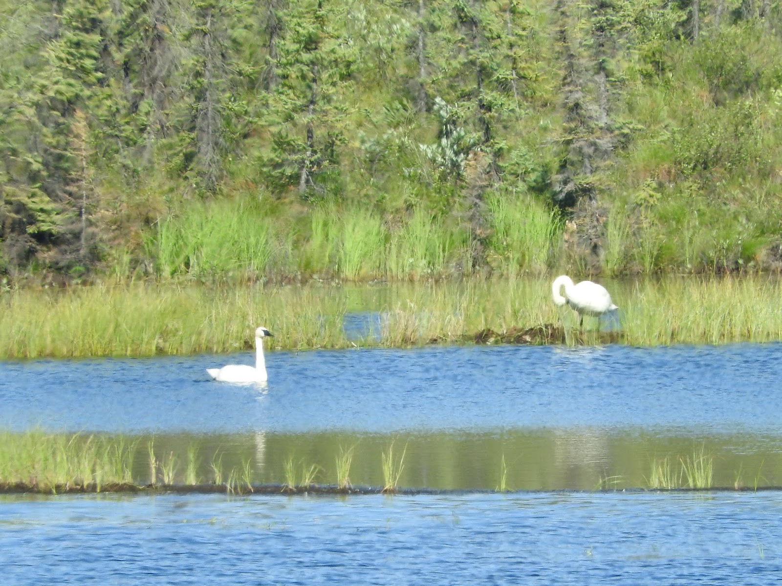
Construction was as advertised, but didn’t seem quite as bad as we’d heard.  But there were a lot of gravel/dirt sections and we kept our speed down.   The tedium was broken up by several animal sightings.  The first were these swans.

They might be trumpeter swans, who migrate back to this area each summer.  And shortly after, a grizzly bear crossed the road!
Of course, by the time we managed to grab the camera, he was well into the brush.


But at least we both saw the grizzly and have some photographic evidence.   Unlike the fox that appeared by the side of the road a short time later.  I was trying to look up something in the Milepost book and by the time I unearthed the camera, he had trotted back into the woods.

We stopped at a rest area to have lunch and wait for the pilot car to come through to lead us through construction and were lucky enough to visit with some ducks.  They followed me along the shore, probably expecting to get fed, but were mostly enjoying the day.  Several were taking a nap stretched out in the sun on an old deck.


The road construction and traffic:

We did have some beautiful scenery.


Love the snow capped mountains!

And much of the way was lined with wildflowers, the most prevalent of which is the fireweed, so called because it is one of the first things to grow after a wild fire.


Gorgeous!
Deb

Monday, July 13, 2015

Monday, July 13, 2015

We changed our plans; we're now in Tok, Alaska.  More on that in a minute.

Before Alaska became the 49th state of the United States in 1959.  Before the Klondike Gold Rush from 1896-1899 and the Alaska Gold Rush from 1899-1915.  And before U.S. President Andrew Jackson purchased Alaska in 1867, Alaska was a Russian colony.  The Russians started exploring Alaska in 1741, claimed it as a colony, and hunted and traded for furs here.

There are still small Russian-speaking communities in Alaska, and the occasional Russian Orthodox church.  We visited this church in Kenai, Alaska, at the end of the Alaskan tour.  It was only a block away from our campground:


This church was built from logs in 1895-1896 and later covered with siding on the outside and plaster on the inside.  It replaced an earlier church on this site built in 1849.  Father Thomas Andrew, who has been the priest here since 2003, gave us a delightful tour and answered a myriad of questions.  The building was declared a National Historic Landmark in 1970 and is the oldest standing Orthodox church in Alaska.


When I last posted to the blog, we were at the Grand View Café and RV Park along the Glenn Highway, sharing the scenery with some Dall Sheep.  We had planned to drive to Valdez for a couple of nights, then on to Tok.  However, Deb has not been healing quickly and the weather forecast for Valdez was for five straight days of rain.

So we decided to head straight for the town of Tok (rhymes with “poke”).  This change eliminates a full day of driving.  We’ll spend three nights here, letting Deb sleep in and take some extended naps.  With some luck, this should help her feel better.

We stayed at the Sourdough Campground in Tok for one evening on the tour, the day after we departed from Dawson City and drove over the “Top of the World” highway, on our way to Fairbanks.  There’s not a lot to do in Tok, but the campground is one of the nicer ones we’ve visited in Alaska.  Each campsite is surrounded by Aspen and White Spruce trees, and has full hookups (electricity, water, and sewer).  It also has good AT&T cell phone coverage and weak Verizon service

Our current plan is to drive southeast from Tok on Wednesday, saying good-bye to Alaska for this trip.  We’ll spend the next couple of weeks driving through the Yukon Territory and British Columbia on our way to Calgary, Alberta.